| |
Columbia Gorge |
|
| |
|
|
|
|
| |
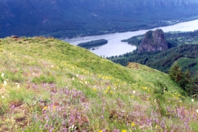
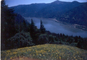
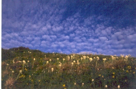
Hamilton Mountain
Day hike. Gain 2000 ft. Round Trip 8 miles.
A beautiful hike in early June that takes one through mature coniferous forest past two waterfalls and onto a ridge that has beautiful views of Mt Hamilton and the Columbia River Gorge. The summit is anticlimactic, but the hike up to the summit is well worth the botanics interest.
Directions: I-5 south to I-205 to hwy. 14. Go east until you reach Beacon Rock State Park. Go left into the campground and up the
hill to the large parking lot. Weekends this place is full.
|
|
 |
|
| |
|
|
|
|
| |
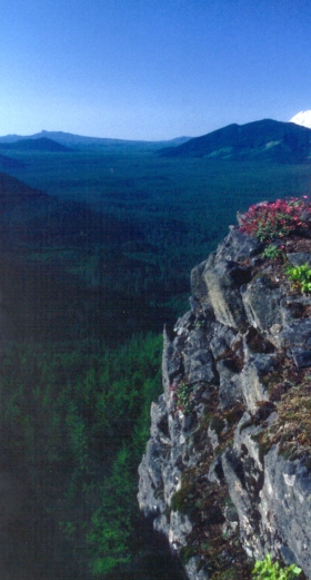
Table Mountain
Day hike. Gain 2000 ft. Round Trip 14 miles.
A strenuous hike that is wonderful. There are some off trails and a difficult trail. Yet the hike is beautiful. Forest, meadows, unique plants and nice views. Part of the trail is on the Pacific Crest trail.
Directions: Past Beacon Rock State Park four miles or there abouts is North Bonneville. Find Moffet Springs Road and turn left off Hwy. 14 go near to the end and find parking alongside the road. Take the obvious trail north. Get maps for this. Mid June. |
|
 |
|
| |
|
|
|
|
| |
Cook Hill
Day hike. Gain 1900 ft. Round Trip 12 miles.
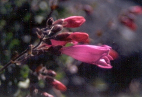
A hike in the mid gorge that includes Dry forests, meadows, views and four different orchids. This is a trail built by Russ Jolley for the wildflower enthusiasts.
Directions: Go east past Dog Mountain on Hwy. 14 to the first paved road and turn left. Park at the first turnout on the right about 100 yd. from the road. Hike back down the road to a little road with a field on the right. hike up that road to a gate that says “no trespassing” Ignore that sign because the forest service owns this land which means we do also. Hike up this road, cross over a stream and continue up to a blue marking cloth. These are the trail markers that will mark the rest of the trail. If you have done this you are about to be happy to not have the crowds at Dog Mountain and you will see two nice meadows on your trip to the summit: one not grazed and the other grazed (15 years ago). Notice the difference. Mid June.
|
|


 |
|
| |
|
|
|
|
| |
Grassy Knoll Lookout
Day hike. Gain 1000 ft. RT. 8 miles
A meadowy hike that needs our awareness, as the Forest Service wants to turn this beauty into a trail for motorcycles and will destroy the beautiful meadows. Start in the meadow and hike up with beautiful views of the big lava bed forest and Mt Adams.
Directions are long and hard. Take I-84 to Bridge of the Gods to the turn off for Cook Hill. Take Cook-Underwood Rd. North to Willard. Go north and west on South Prairie road to lost Creek rd (FR 68) Take road to Jct. FR 511 find parking near the pass. A large meadow is near the parking area. Mid to late June.
|
|


 |
|
| |
|
|
|
|
| |
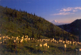
Silverstar Mountain
Day hike. Gain 2000 ft. RT. 11 miles
A 4400 ft mountain that is a beauty for flower lovers. 80 species were in bloom on Solstice day last year! This hike has miles and miles of flower meadows, views, native American pits and wonderful enchantments.
Directions: There are many routes up this mountain. For the first time go to Washougal off Hwy. 14 take the Washougal River Road across the river. (you might need to ask) and take it north and east along the beautiful river to NE 26th St. go left and go to Skye Rd turn right, immediately turn left on Skamania mines road. Head north and stay on Skamania Mines rd until you find 2.8 miles away Rd 1200 go right another 2.3 miles to the pass and park. Hike up on the east side go up and not on the Tarbell trail. Climb 500 ft and you are now on the ridge that will take you to the summit in three miles. Late June to Early July.
|
|


 |
|
| |
|
|
|
|
| |
Catherine Creek |
|


  |
|
| |
|
|
|
|
| |
Cape Horn Loop |
|

 |
|